 Makes a great gift!
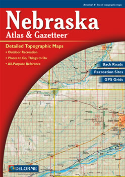
Nebraska DeLorme Atlas
Complete Nebraska Road Map and
Topographic Map Coverage
- Large 11" x 15.5" Pages
- Topo Maps with Back Roads
- 65 Pages of Maps
- 15 Pages of Attractions, Information and Places to Visit
- Scale: 1:200,000 (1" = 3.2 miles)
The atlas can help you to:
- Map a scenic drive along the Trails West Tour
- Plan a weekend excursion to Ashfall Fossil Beds
- Explore historic districts of Omaha
- Learn what types of fish are caught in Johnson Lake
|
Ships right away by Priority Mail
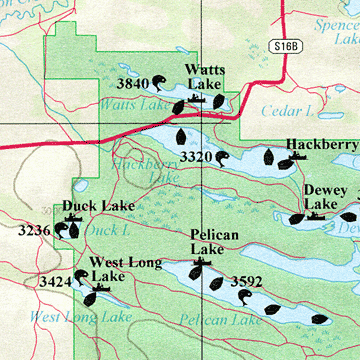
A Sample Map From This Book
Some of the Map Symbols
 |
Attractions |
 |
Bicycle Routes |
 |
Campgrounds |
 |
Fishing |
 |
Wildlife Viewing |
 |
Hiking |
 |
State Parks and Recreation Areas |
 |
Scenic Drives |
 |
Historic Sites |
 |
Hunting
|
 |
Paddling |
 |
Unique Natural Features |
The detailed maps show physical features, such as lakes, rivers, streams, valleys, grasslands and mountains. Other features include: towns, cities, ranches, Indian Lands, roads, airports, trails, highways, interstates, parks and wildlife refuges. The DeLorme Atlas and Gazetteer is a map collection, recreation guide and travel planner in one useful book!