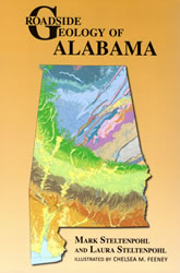
Roadside Geology of Alabama
by Mark Steltenpohl and Laura Steltenpohl
Roadside Geology of Alabama
|
|
| Preface and Acknowledgments |
viii
|
| INTRODUCTION |
1
|
| Geologic Time |
2
|
| The Not-So-Secret Life of Rocks |
3
|
| Plate Tectonics |
7
|
| Faults and Folds |
10
|
| Alabama Through the Ages |
13
|
| Precambrian Era |
13
|
| Paleozoic Era |
17
|
| Mesozoic Era |
19
|
| Cenozoic Era |
21
|
| Energy and Mineral Resources |
24
|
| Earthquakes... in Alabama? |
29
|
| Landscape Provinces |
30
|
| HIGHLAND RIM AND CUMBERLAND PLATEAU |
33
|
| Karst Features |
41
|
| I-22: Mississippi - Birmingham |
43
|
| I-59: Gadsden - Georgia |
49
|
| Little River Canyon National Preserve |
51
|
| DeSoto State Park |
52
|
| Battelle: An Ironworks Ghost Town |
54
|
| I-65: Tennessee - Birmingham |
55
|
| US 72: Mississippi - Huntsville |
61
|
| Rockpile Park at Wilson Dam |
64
|
| Monte Sano |
67
|
| Natchez Trace Parkway: Tennessee - Mississippi |
68
|
| US 231: Huntsville - Ashville |
71
|
| US 431: Tennessee - Gadsden |
78
|
| Cathedral Caverns State Park |
81
|
| Noccalula Falls and Black Creek Trail |
84
|
| VALLEY AND RIDGE |
87
|
| Fold-and-Thrust Belt |
87
|
| Transverse Zones and Mushwads |
94
|
| I-20: Oxford - Birmingham |
96
|
| Ruffner Mountain Nature Preserve |
100
|
| I-20/I-59: Birmingham - Tuscaloosa |
101
|
| Tannehill Ironworks Historical State Park |
104
|
| I-459 (Birmingham Bypass): McCalla - Trussville |
109
|
| I-59: Birmingham - Gadsden |
112
|
| I-65: Birmingham - Calera |
115
|
| Oak Mountain State Park |
118
|
| Red Mountain Park |
120
|
| US 231: Ashville - Harpersville |
121
|
| US 280: Birmingham - Sylacauga |
124
|
| McWane Science Center |
127
|
| Red Mountain Expressway Cut |
129
|
| National Carbon Capture Center |
139
|
| US 431: Gadsden - Oxford |
142
|
| PIEDMONT |
149
|
| A Patchwork of Terranes |
151
|
| I-20: Georgia Line - Oxford |
167
|
| I-65: Calera - Clanton |
167
|
| Diamictite at Lay Dam |
170
|
| I-85: Georgia - Auburn |
171
|
| Chewacla State Park |
173
|
| US 231: Sylacauga - Montgomery |
175
|
| Wetumpka Impact Crater |
181
|
| US 280: Sylacauga - Opelika |
184
|
| US 431: I-20 near Oxford - Opelika |
195
|
| US 280/US 431: Opelika - Phenix City |
206
|
| AL 49: Cheaha State Park - Lineville - Dadeville |
212
|
| High Falls, Pyriton, and Clairmont Springs |
215
|
| Almond Trondhjemite at Flat Rock Park |
219
|
| Horseshoe Bend National Military Park |
222
|
| COASTAL PLAIN |
225
|
| Folds and Faults |
232
|
| I-20/I-59: Tuscaloosa - Mississippi |
234
|
| I-65: Clanton - Mobile |
237
|
| Point A Dam Fossil Locality |
243
|
| Sir Charles Lyell and Claiborne Bluff |
244
|
| I-85: Auburn - Montgomery |
247
|
| Fossils of Late Cretaceous Flowering Plants |
249
|
| US 43: Demopolis - Mobile |
250
|
| Salt Mountain |
259
|
| St. Stephens Historical Park |
260
|
| US 80: Mississippi - Montgomery |
262
|
| The End-of-Cretaceous Meteor Impact |
265
|
| How to Hatch a Dinosaur Egg |
268
|
| US 82: Mississippi - Montgomery |
270
|
| The Hillabee Celt and Moundville Archaeological Park |
273
|
| US 231: Montgomery - Florida |
275
|
| Alabama's T-Rex |
277
|
| US 431: Phenix City - Dothan |
282
|
| Fossils of the Ingersoll Shale |
285
|
| Fighting Gravity to Keep Roads Safe |
286
|
| COASTAL LOWLANDS |
293
|
| I-10: Mississippi - Mobile - Florida |
296
|
| US 98 and Alternate US 98: Mississippi - Mobile - Florida |
297
|
| Miocene Fossils Hold Clue to Evolution of Mammals |
298
|
| Alternate US 98 along Eastern Shore |
300
|
| AL 180 and AL 182: Fort Morgan - Florida |
303
|
| CSS Ivanhoe, a Confederate Blockade Runner |
304
|
| West Beach Boulevard to Lagoon Pass Park |
307
|
| Gulf State Park |
308
|
| AL 193: Mobile - Dauphin Island |
309
|
| Flow Direction of the Fowl River |
309
|
| Dauphin Island |
310
|
| Mobile Bay Ferry Route |
316
|
| GLOSSARY |
318
|
| REFERENCES |
325
|
| INDEX |
332
|
ADVERTISEMENT
