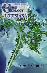
Roadside Geology of Louisiana
by Darwin Spearing
Roadside Geology of Louisiana
|
|
| I. Preface |
ix
|
| II. Acknowledgments |
xiii
|
| III. Geologic Overview |
1
|
| A) Geologic Time |
1
|
| B) Geologic History of Louisiana |
5
|
| C) Structure Below |
17
|
| D) Salt Domes |
19
|
| E) Oil and Gas |
25
|
| F) Minerals |
30
|
| G) Rivers in Motion |
31
|
| H) Dynamic Deltas |
34
|
| I) Mississippi Fan |
39
|
| J) How the Mississippi River Grew |
41
|
| K) Wetlands Loss |
44
|
| IV. Southeastern Louisiana Uneasy Rivers, Marshes and Deltas |
49
|
| A) Atchafalaya Basin |
50
|
| B) New Orleans |
57
|
| C) Pontchartrain Causeway and Lake Pontchartrain |
60
|
| D) Interstate 10: Baton Rouge-Lafayette |
64
|
| E) Interstate 10: New Orleans-Baton Rouge |
67
|
| F) Interstate 10: New Orleans-Slidell-Mississippi |
69
|
| G) Interstate 55: Hammond (I-12)-Interstate 10-Lake Maurepas |
69
|
| H) US 90: Lafayette-Morgan City |
70
|
| I) US 90: Morgan City-Houma |
73
|
| J) US 90: New Orleans-Des Allemands-Raceland-Houma |
75
|
| K) Louisiana 1: Port Allen-Donaldsonville-Thibodaux-Raceland |
76
|
| L) Louisiana 1: Raceland-Golden Meadow- Grand Isle |
78
|
| M) Louisiana 14, Louisiana 329: Avery Island |
83
|
| N) Louisiana 23: New Orleans-Venice-Tidewater |
85
|
| O) Louisiana 83, Louisiana 319: Weeks Island-Cypremort State Park-Cypremort Point |
92
|
| P) Louisiana 675: Jefferson Island |
94
|
| V. Eastern Louisiana Red Hills Above Pontchartrain |
97
|
| A) Interstate 12: Baton Rouge-Hammond-Slidell |
101
|
| B) Interstate 55: Hammond-Kentwood Quarry-Mississippi |
103
|
| C) Interstate 59: Mississippi-Slidell |
107
|
| D) US 61: Baton Rouge-St. Francisville-Mississippi |
107
|
| E) Louisiana 21, Louisiana 41: Mississippi- Bogalusa-Interstate 59 |
109
|
| VI. Southwestern Louisiana Marsh to the Sea |
111
|
| A) Interstate 10: Lafayette-Jennings-Lake Charles-Sulphur-Texas |
115
|
| B) Louisiana 27: Sulphur-Hackberry-Holly Beach |
121
|
| C) Louisiana 27/14: Lake Charles-Oak Grove |
124
|
| D) Louisiana 82: Sabine Pass-Holly Beach-Cameron |
126
|
| E) Louisiana 82, US167: Cameron-Pecan Island-Abbeville-Lafayette |
129
|
| VII. Central Louisiana Great Rocks and Great Rivers |
133
|
| A) Interstate 49: Alexandria-Opelousas-Lafayette |
135
|
| B) Interstate 49: Alexandria-Natchitoches |
136
|
| C) US 84: Tullos-Jena-Archie |
140
|
| D) US 84: Vidalia-Ferriday-Archie |
141
|
| E) US 84, Louisiana 6: Natchitoches-Winnfield Salt Dome-Winnfield |
142
|
| F) US 84, Louisiana 34: Winnfield-Tullos |
147
|
| G) US 165: Alexandria-Georgetown-Tullos |
147
|
| H) US 165: Alexandria-Oakdale-Iowa (I-10) |
148
|
| I) US 167: Alexandria-Winnfield |
149
|
| J) US 171: Lake Charles-DeRidder-Leesville-Many |
150
|
| K) Louisiana 378: Sam Houston Jones State Park |
155
|
| L) Louisiana 1: Baton Rouge-Simmesport-Marksville-Alexandria |
157
|
| M) Louisiana 6: Sabine River-Many-Natchitoches |
161
|
| N) Louisiana 8/28: Alexandria-Leesville-Sabine River |
162
|
| O) Louisiana 15: Ferriday-Three Rivers Area-Old River Control Structures-Lettsworth |
163
|
| P) Louisiana 28: Alexandria-Walters-US 84 Junction |
168
|
| Q) Louisiana 107: Alexandria-Moncla Gap-Marksville |
169
|
| R) Louisiana 129: Features of the Floodplain |
172
|
| VIII. Northern Louisiana Oldest Rocks, Highest Hills |
177
|
| A) Interstate 20: Texas-Shreveport-Monroe-Vicksburg |
179
|
| B) Interstate 49: Shreveport-Natchitoches |
183
|
| C) US 65: Tallulah-Ferriday |
188
|
| D) US 65: Tallulah-Lake Providence-Arkansas |
189
|
| E) US 79: Minden-Homer-Haynesville-Arkansas |
191
|
| F) US 165: Monroe-Bastrop-Arkansas |
192
|
| G) US 165: Monroe-Columbia-Tullos |
193
|
| H) US 167: Ruston-Dubach-Bernice-Arkansas |
194
|
| I) US 167: Ruston-Jonesboro-Winnfield |
196
|
| J) US 171: Shreveport-Mansfield-Many |
196
|
| K) Louisiana 1: Shreveport-Oil City Arkansas |
197
|
| L) Louisiana 3: Shreveport-Benton-Plain Dealing-Arkansas |
199
|
| M) Louisiana 7: Dixie Inn-Cotton Valley-Springhill-Arkansas |
199
|
| N) Louisiana 15: Monroe-Winnsboro-Sicily Island-Clayton |
200
|
| O) Louisiana 17, Louisiana 134, Louisiana 577: Delhi-Poverty Point State Commemorative Area |
201
|
| IX. Hurricanes Katrina and Rita, 2005 |
203
|
| X. Glossary |
205
|
| XI. Credits |
210
|
| XII. References |
211
|
| XIII. Maps and Information |
215
|
| XIV. Index |
217
|
| XV. About the Author |
225
|
ADVERTISEMENT
