Makes a great gift!
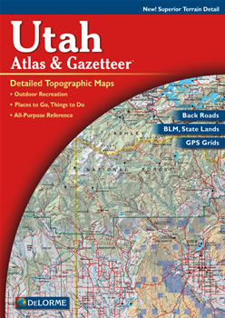
Utah DeLorme Atlas
Complete Utah Road Map and
Topographic Map Coverage
- Topo Maps with Back Roads
- 48 Pages of Maps
- 16 Pages of Attractions, Information and Places to Visit
- Scale: 1:250,000 (1" = 4 miles)
Some suggested ways to use this atlas:
|
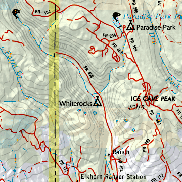
A Sample Map From This Book
Some of the Map Symbols
| Outdoor Adventures | |
| Family Outings | |
| Campgrounds | |
| Recreation Areas | |
| Hunting | |
| Fishing | |
| Unique Natural Features | |
| Boat Launch Site | |
| Golf Course | |
| Public Campgrounds | |
| Rest Area | |
| Information Centers | |
This atlas has an index of the state's place names for easy look-up. The back cover of this atlas has a large map of Utah with an overlying grid. Each cell of the grid contains the page number for a detailed map of that area. The maps show both physical and man-made features. These include: mountains, valleys, deserts, forests, rivers, lakes, creeks, cities, towns, railroads, roads, highways, interstates, reservations, test areas, parks and wildlife refuges. State-wide topographic information is shown by contour lines with intervals of 300 feet. You will be impressed with the detail of the DeLorme Atlas and Gazetteer!